Damaging wind warning issued for much of Victoria
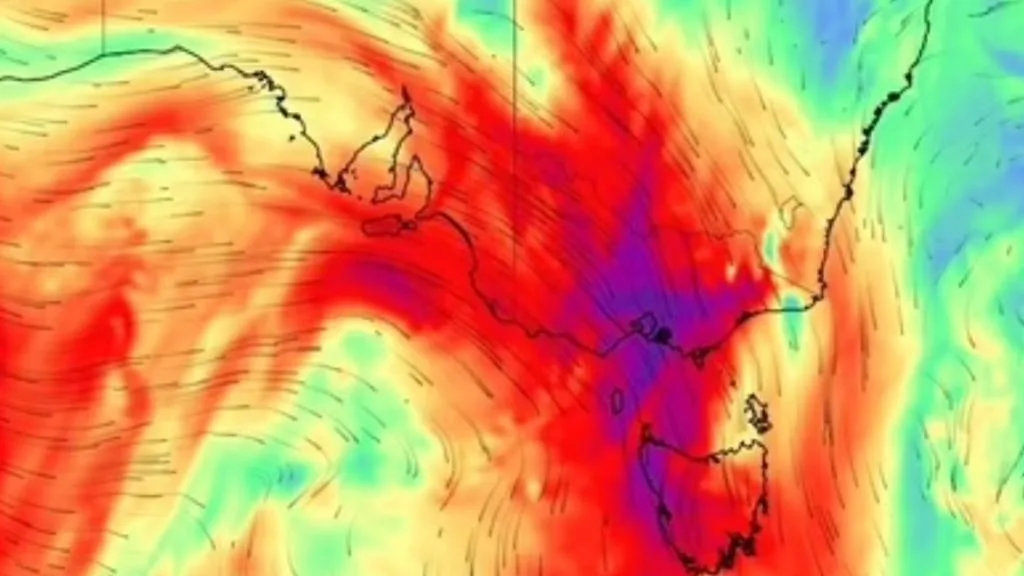
Damaging winds are hitting most people in Victoria as storms roll over the state on Wednesday.
The Bureau of Meteorology has issued damaging wind warnings for the central, north central, northeast and western parts of the state as well as south and east Gippsland.
“A strong northerly flow is forecast to develop this morning ahead of a trough crossing Victoria, bringing strong winds over central and eastern parts of the state,” the warning says.
“Winds will then tend north-westerly and ease during the afternoon in the wake of the trough.”
Winds averaging 60 to 70km/h are in the offing, with gusts up to 90km/h, extending into Melbourne and parts of the Mornington and Bellarine peninsulas.
The strongest recorded winds so far have been 94km/h at Mt Hotham, which has also recorded sustained 67km/h winds on Wednesday.
The bureau warns that people should avoid travel if possible and tie down unsecured objects around the outside of their homes.
Around midday in Melbourne the sun was totally drowned out by heavy clouds, as rain fell heavily, coming in on a 45 degree angle on the strong winds. Bendigo has recorded 14.6mm of rain in the three hours to midday.
Isolated and short-lived thunderstorms have been seen on Wednesday morning across a large area of western Victoria.
The strong high pressure ridge is bringing showers and isolated storms to South Australia, western NSW and Tasmania as well.
In northern parts, Darwin and the Adelaide River regions are on fire alert on Wednesday, with warm, dry and gusty conditions prompting a pre-emptive warning for residents to be prepared with their bushfire survival plans.
Originally published as Damaging wind warning issued for much of Victoria
5News aggregated this summary from the outlet’s public feed. The full article, with all the context, is on www.perthnow.com.au — the content belongs to PerthNow.