The collapse of a mountainside triggered Nepal’s devastating floods. As the region’s mountains heat up, it won’t be the last
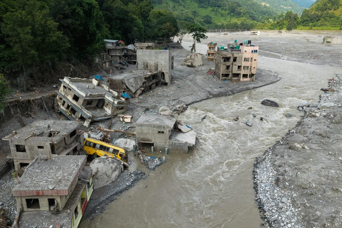
Prabin Ranabhat/AFP via Getty On the morning of August 26, a section of mountain near Langtang Lirung peak in Nepal suddenly collapsed.
A huge mass of rock, ice and debris plunged roughly 1,200 metres into the valley below, producing a hugely destructive flood on the Lhende Khola river.
The flow travelled almost 100 kilometres downstream, washing villages and bridges away.
Almost 1,000 people died and thousands more are still missing across the Nepal-China border.
What caused it? At first, it looked like a glacier collapse.
But emerging satellite and photographic evidence suggests a more complex picture – an avalanche of rock and ice, rather than a simple glacier collapse.
The mountain face now has a sharply defined scar after the collapse, clearly marking the boundary between the remaining slope and the section which failed.
This isn’t the first rock-ice avalanche in the Himalayas, but it is by far the most devastating.
Unfortunately, it is unlikely to be the last.
Rising temperatures due to climate change mean the permanently frozen slopes of mountains in the region may begin to melt and destabilise.
How did a mountain collapse? The steep mountain face was topped by a glacier – a heavy river of ice.
It’s likely that the steep slope of bedrock collapsed first, followed by the overhang of ice.
As this enormous mass fell into the valley, it created a tremendous amount of energy.
This would likely have melted the ice in the avalanche and any in the valley, adding large volumes of faster-moving water to the flow and intensifying the debris flood.
5News aggregated this summary from the outlet’s public feed. The full article, with all the context, is on theconversation.com — the content belongs to The Conversation Australia.