A terrifying roar then came the fury of the flood: How disaster unfolded in Nepal
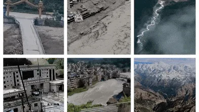
To many who survived the disaster that struck parts of Nepal and China, the threat came out of the blue.
Most of the region had seen little or no rain. The skies over much of the region were blue and clear. Suddenly, a mass of ice, mud, water, debris and rock began to barrel along narrow Himalayan canyons, obliterating the towns and villages, bridges and power stations, farms and schools that were nestled along the riversides and valley floors.
This disaster, overwhelming everything in its path with terrifying power and force, is complex and difficult to analyse. Here is what we know so far - and what remains uncertain.
So inaccessible are many of the high peaks of the region that experts are still trying to piece together exactly what caused the disaster, relying not only on survivor accounts and vision posted on social media, but satellite imagery and seismic monitoring data.
What is known is that a magnitude 5.2 seismic event occurred near the Nepal-China border at 8.37am local time. It registered as a 4.4 earthquake, but later the United States Geological Survey reported that the seismic activity detected was likely the avalanche itself, rather than an avalanche caused by an earthquake.
“The root cause of this disaster is already known, although there is a lot of misinformation and some uncertainty,” wrote Dave Petley, a leading British earth scientist for Eos , an online journal for the American Geophysical Union.
“There has been some speculation, and indeed official comments, that the trigger was an earthquake. This is likely to be a misinterpretation of the data; the seismic signal is almost certainly the rock ice avalanche and debris flow, not a tectonic event.”
This analysis lends weight to early reports that the “snout” of a glacier on the side of Mt Langtang Lirung, the highest peak of the Langtang Himal, a range of the Nepalese Himalayas, had broken free and fallen over a kilometre into the valley beneath.
Earth scientist Dan Shugar, an associate professor at the University of Calgary, told Reuters that satellite imagery seemed to show that a large amount of snow had melted in the 24 hours before the disaster.
“Some of the glaciers in the valley were covered in snow yesterday and today they are mostly bare ice. So in other words (and I haven’t seen any weather station data yet), it was probably warm,” he said.
“What I can see in this morning’s satellite imagery from Planet Labs, the lower part of a glacier broke off at about 5200 metres and crashed onto the valley floor about 1200 metres below,” Shugar said.
The force of that mass falling that far would have been catastrophic, Dr Anil Kulkarni, a distinguished scientist with the Divecha Centre for Climate Change at the Indian Institute of Science, told this masthead.
“The moment it hits the ground with such an explosion, it gets converted into water,” Kulkarna said.
“All that potential energy [in the mass of rock and ice] converts into kinetic energy and liquid in a very short period of time,” said Kulkarni, who has also been studying satellite images of the disaster zone captured before and after the collapse as part of the international response to the disaster.
5News aggregated this summary from the outlet’s public feed. The full article, with all the context, is on www.brisbanetimes.com.au — the content belongs to Brisbane Times.