'Super' El Niño didn't cause this year's fires and heat waves, but it's about to take us on a 'wild ride'
Whether you call it a "super" El Niño or a "Godzilla" El Niño , the Pacific Ocean warming event that disrupts global weather patterns is back and packing a punch, at a time when many parts of the planet are already overheated.
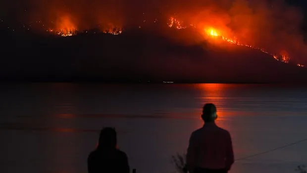
This July was the hottest on record for North America and Europe, where successive heat waves have led to thousands of heat-related deaths, dried up rivers and fire-scorched landscapes. That includes Canada, which has already seen more than 4.1 million hectares of woodland go up in flames and produce thick smoke that blanketed much of the eastern half of the country and parts of the northern U.S.
Although this scorching summer aligned with the arrival of an El Niño and climate scientists say it's not to blame for those devastating extreme weather events. However, they note we may only be starting to see how this naturally occurring phenomenon could amplify extreme weather already super-charged by fossil-fuel driven climate change.
El Niño is here, and it’s already looking like it could be 'mind-blowing'
"El Niño's impacts are going to be large and broad across a huge area," said Josh Willis, a climate scientist at NASA's Jet Propulsion Laboratory.
El Niños occur naturally every three to seven years, usually beginning in spring and enduring well into the following year, as the water surface temperature in the area of the Pacific where they form along the equator, rises at least 0.5 C above the average.
Willis says that warming heats up the air above the water and "rearranges the atmosphere."
"It flips the weather upside down," he said, causing drier places to get heavier rainfall and wetter regions to dry up.
Although this El Niño may have begun forming in May and June just as successive heat waves and fires began to scorch the northern hemisphere, Willis says they usually don't start to impact northern places like Canada until they peak in the late fall and winter.
But Muhammad Azhar Ehsan, a scientist at the Center for Climate Systems Research (CCSR) at New York's Columbia University, says this El Niño is so unprecedented that while he can't directly link it to current heat and wildfire conditions, he does wonder if the "exceptional" temperatures associated with it could be contributing to these disasters.
Ehsen says this El Niño is on track to rival those experienced in 2015-16 and 1997-98, the strongest El Niños since official records began in 1950.
Models suggest much of Canada and the northern U.S. can expect a warmer winter than usual due to this El Niño, with British Columbia 's normally wet south coast potentially seeing far less precipitation and a much lower snowpack.
The southern U.S., meanwhile, is likely to experience a much wetter winter.
There are also noticeable effects happening right now in the tropics that Willis says are likely associated with El Niño. He says the phenomenon "sort of juices up" conditions that may already be occuring.
5News aggregated this summary from the outlet’s public feed. The full article, with all the context, is on www.cbc.ca — the content belongs to CBC News.