Facts and science behind the Nepal mudslide
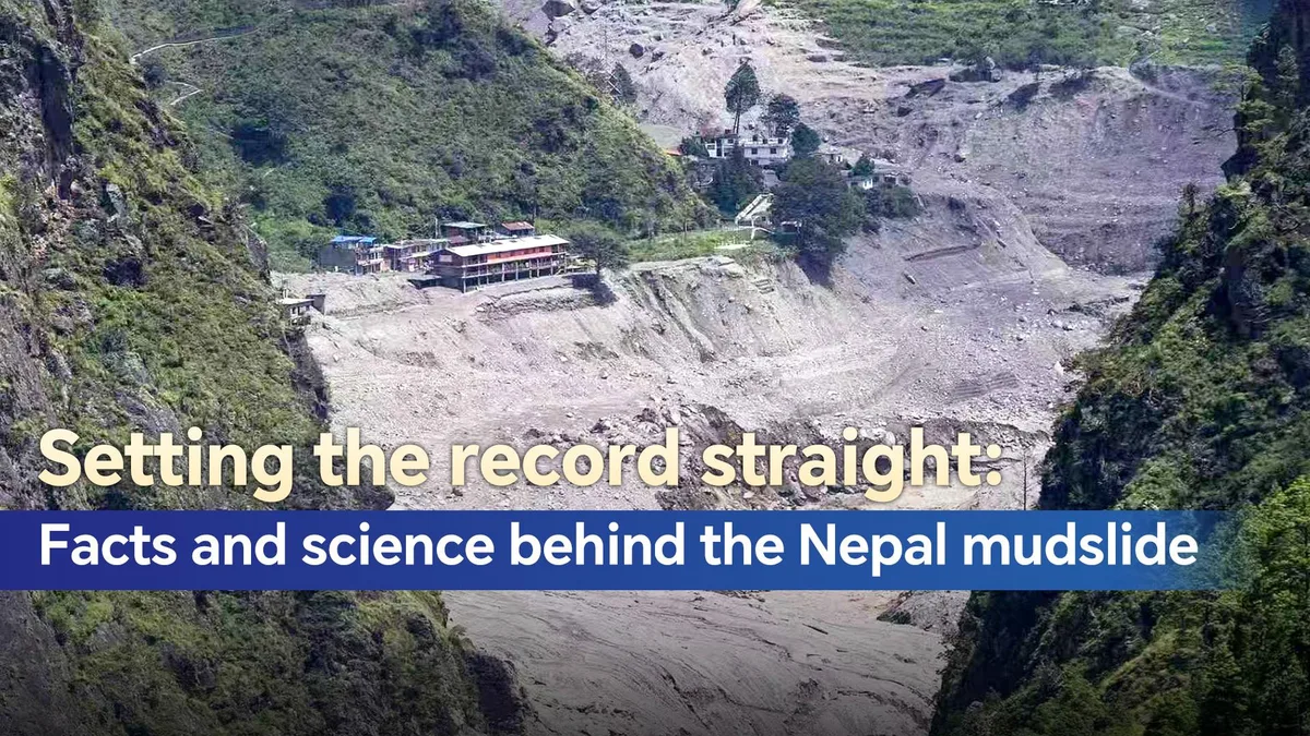
On the morning of August 26, a massive mountain disaster struck the China-Nepal border.
A glacier collapse in Nepal triggered an ice‑rock avalanche, which evolved into a devastating debris flow and flash flood.
A wall of ice, rock and debris plunged from the northern slope of Langtang Lirung in Nepal, roughly 5,200 meters above sea level.
In a mere seven minutes, this destructive force travelled 22 kilometers through deep mountain gorges and slammed into Gyirong Port in southwest China's Xizang Autonomous Region, destroying roads, buildings and claiming lives on both sides.
The speed and scale of the disaster have raised difficult questions: Where did it actually begin? What made it so destructive? Could it have been predicted? And what can be done to reduce the risks before the next such event? Where did the disaster begin? According to the US Geological Survey (USGS), the catastrophic debris flow and flooding was likely triggered by rapid slope failure involving a glacier in Nepal's Langtang National Park, near the China-Nepal border.
The USGS estimated that the resulting debris flow and flood travelled nearly 100 kilometers downstream.
Chinese geological experts reached a similar preliminary conclusion.
The Ministry of Natural Resources said analysis of high-resolution satellite imagery before and after the event, combined with seismic data and images from the disaster area, showed that the source was in Nepal, in the upper reaches of the Cuojian River, a tributary upstream of the Gyirong Port area.
The Xizang regional government further verified and mapped out the complete disaster propagation path: a glacier on the northern slope of Langtang Lirung fractured at an altitude of around 5,200 meters, descended to roughly 4,000 meters, and then travelled about 22 kilometers along the river channel before reaching Gyirong Port.
Nepal's Department of Hydrology and Meteorology has also received preliminary information indicating that an ice avalanche on the Nepali side may have temporarily dammed the Lhende River, forming a short-lived barrier lake before water surged downstream.
How ice rock collapse turned into a mudslide, and why the disaster was so destructive The answer lies partly in the region's extreme terrain.
The collapse initiated at roughly 5,200 meters above sea level, dropped to around 4,000 meters, and continued down a steep valley for more than 20 kilometers toward terrain sitting at about 1,800 meters elevation.
That enormous vertical drop endowed the initial mass failure event with tremendous kinetic energy.
Chinese experts with the Ministry of Natural Resources estimate the debris flow moved at an average speed exceeding of 50 meters per second – over 180 kilometers per hour.
此摘要由5News从媒体的公开信息源汇聚而成。 包含完整背景的全文在www.cgtn.com — 内容归CGTN China (oficial)所有。