Super El Nino winter weather forecast: What December, January and February could bring across the US
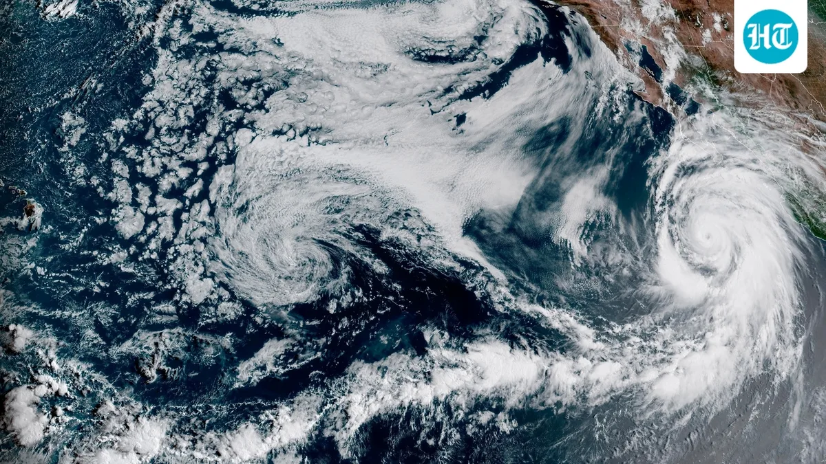
As fall approaches, experts are warning about a record-strong El Nino, which some are calling a "super El Nino." This weather pattern could affect temperatures and rainfall around the world and may raise the risk of extreme weather in some regions.
As per CNN , it is expected to become a Super El Nino by October, with almost a 70% chance of becoming the strongest El Nino ever recorded by the end of the year.
As per TIME , El Nino and its opposite, La Nina, are natural weather patterns that occur in the tropical Pacific Ocean. During an El Nino year, the water in the central and eastern Pacific becomes warmer than normal. During La Nina, the water becomes colder than normal. These changes can affect weather around the world, bringing more storms to some places and drought to others.
Risper Nyairo, an assistant professor of environmental studies at Davidson College, said, “Pacific sea surface temperatures are going to vary at least two degrees from the average.”
Warmer ocean water can cause more evaporation, putting more moisture into the air. This can lead to more rain in some areas, while dry land can become even drier in others.
Also read: NOAA winter weather forecast map: Which US states could see more rain and snow this year?
As per CNN, no two El Nino winters are exactly the same, but they usually follow some similar weather patterns. El Nino often pushes the jet stream, the band of air that carries storms across the country, farther south than normal.
This can bring more storms and wetter, cooler weather to the southern US . At the same time, the northern US can see warmer and drier conditions. During strong El Nino winters, the Northeast also tends to get less snow than usual.
The Southeast and southern Plains can also have cooler and wetter weather. Depending on how cold it gets, this can lead to snow, sleet or freezing rain.
As per CNN, El Nino can also affect severe thunderstorms. These storms usually become more active near the Gulf Coast from late fall into winter. Florida faces a higher risk of severe thunderstorms during El Nino winters, while other parts of the Gulf Coast are usually quieter than normal, according to Michael Tippett, a climate scientist at Columbia University.
Also read: Old Farmer's Almanac weather forecast for September 8-18: What weather will the US see?
As per Newsweek , AccuWeather's lead long-range forecaster, Paul Pastelok, expects an increased chance of heavy rain across central and Northern California in December, possibly reaching the Northeast too, along with snow in the Sierra mountains.
Pastelok said, "Another storm track could evolve from the Gulf coast to the mid-Atlantic, with heavier rain for the Southeast and Tennessee Valley [and] severe thunderstorms in the Southeast and mid- Atlantic . Meanwhile, very mild conditions can occur across the Great Lakes, Midwest and Northeast, compared to average."
Pastelok said January could look similar to December, with a strong storm track moving into the West Coast, mainly California and Nevada and continuing toward the Four Corners region.
5News aggregated this summary from the outlet’s public feed. The full article, with all the context, is on www.hindustantimes.com — the content belongs to Hindustan Times - World.