Satellites Watched a Himalayan Glacier Speed Up for Weeks Before It Unleashed a Flash Flood That Killed Over 1,000 People
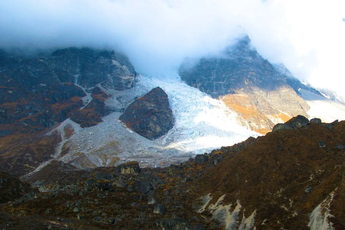
Relief workers and volunteers are still scrambling to save lives one week after a huge, glacier-coated chunk of mountain near Langtang Lirung peak collapsed catastrophically , raining rock, ice, and a debris-filled slurry of flood waters down into the Nepal-China border below. The current death toll has climbed to 1,114 people, according to the Nepalese government, with nearly 4,000 more still reported missing.
The tragedy has pushed geologists , climate scientists , and geoscientists within the specialized discipline of glaciology to revisit what data they had on hand that might have helped sound the alarm before Nepal’s avalanche flooded rivers and washed away villages downstream. The warning signs were there, according to Virginia Tech geophysicist Manoochehr Shirzaei, who told the journal Nature that subtle but accelerating movement was visible in the mass of glacial ice and supporting rock beneath it for weeks before the disaster.
Shirzaei and his colleagues analyzed data from the European Space Agency’s Sentinel-1 satellites, an “all weather” constellation that uses C-band synthetic aperture radar to peer through any degree of cloud cover to image the Earth below. They acquired Sentinel-1 data covering Langtang Lirung peak from January 8 to August 18, 2026—just a week before the avalanche cascaded down 3,900 feet (1,200 meters) into the Lhende Khola river below.
“We detected evidence that the glacier–rock system was slowly moving downhill near the apparent collapse area, with velocities reaching roughly 10 millimetres [0.39 inches] per month,” Shirzaei told Nature. While that speed was not particularly alarming—glaciers can typically move at speeds around 10–200 meters [33–656 feet] per year—the pace at which that speed was ramping up was truly a worrying indicator.
“The acceleration is more important than the velocity, because it suggests that the rate of slope deformation was changing in the days leading up to the disaster,” Shirzaei explained. “[Our] analysis also indicates acceleration of rock and ice near the potential failure zone.”
Shirzaei emphasized that monitoring for apparent acceleration along critical glaciers would only be one facet of a modernized early warning system for avalanches. Synthetic aperture radar systems like Sentinel-1 could only be a powerful pre-screening tool—best automated, Shirzaei believes, via algorithm.
“Once a slope begins behaving anomalously, monitoring could become much more intensive,” he explained. “High-resolution commercial radar and optical satellites could be used, and where practical, ground instruments such as cameras and seismic sensors could be deployed.”
But, Shirzaei noted, identifying a glacier at risk of collapse is only half the battle. Governments would have to highly tailor their responses and analyses, pairing advanced warnings with deep geophysical and hydrological research modeling local terrain, the conditions and risks posed to nearby rivers and lakes, and other specific information.
5News aggregated this summary from the outlet’s public feed. The full article, with all the context, is on gizmodo.com — the content belongs to Gizmodo.