Pinglu Canal showcases smart technologies in landmark waterway project
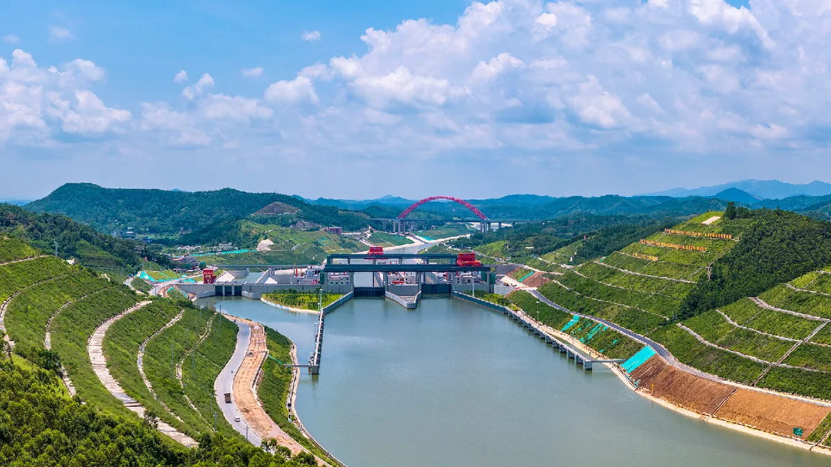
The Pinglu Canal in south China's Guangxi Zhuang Autonomous Region will become operational on Wednesday, it was announced at a press conference on the canal's opening on September 7.
The 134.2-kilometer canal, linking the Xijiang River shipping route in the north with the Beibu Gulf in the south, is China's first major river-to-sea canal project that has been planned and coordinated at the national level since 1949.
Beyond serving as a major water transport route, the Pinglu Canal is China's first smart canal designed with digital technologies throughout its entire life cycle.
With a navigation capacity of 5,000-tonne-class vessels, large vessels can travel directly through the waterway.
The canal will provide a more direct route for cargo from Guangxi and other parts of southwest China to reach the sea, cutting more than 560 kilometers from the inland waterway journey compared with traditional routes.
It is expected to save more than 5 billion yuan (about $700 million) in transportation costs each year.
The project necessitated a total excavation volume of 315 million cubic meters, nearly three times that of the Three Gorges project.
The canal is home to an inland water-saving ship lock featuring the world’s highest lift for such a facility.
The maximum elevation difference between its upstream and downstream water levels is 29.6 meters, equivalent to the height of a 10-story building.
It also features the world’s largest inland water-saving ship lock, with a chamber 300 meters long and 34 meters wide, covering an area roughly equivalent to 1.5 standard football fields.
A digital engine powering a smart canal At the heart of the Pinglu Canal's smart capabilities is its digital twin platform, which serves as the waterway's "digital brain." The platform creates a digital replica of the physical canal, covering all major scenarios, including ship locks, waterways, anchorage areas and service zones.
By integrating automatic vessel identification systems with shore-based sensing equipment and leveraging technologies such as BeiDou Navigation Satellite System, cloud computing and artificial intelligence, it reproduces the canal in a virtual environment.
The platform enables real-time visualization of navigation scheduling and risk alerts, allowing dispatchers to monitor the operational status of the entire canal from control centers without having to visit the site.
An electronic navigational chart has also been put into operation, providing vessels with navigation guidance much like a digital map.
此摘要由5News从媒体的公开信息源汇聚而成。 包含完整背景的全文在www.cgtn.com — 内容归CGTN Tech & Sci (oficial)所有。