How China is making more out of its maps
Editor's note: August 29 marks China's National Surveying and Mapping Law Publicity Day.
On the occasion of this year's 23rd observance, CGTN, at the invitation of China's Ministry of Natural Resources, looks at how China is getting more out of its maps, as surveying and mapping data are increasingly used across disaster management, public services and economic development.
With its vast territory, diverse terrain and monsoon climate, China is frequently affected by natural disasters.
Last June, however, an encouraging case took place in the southern province of Guangdong, where officials in Zhonghe Village evacuated residents hours before a landslide struck.
While authorities stress that the key to effective disaster prevention lies with personnel on the ground, from conducting patrols to organizing timely evacuations, their work is increasingly supported by a broader system that collates data from across government departments.
One is China's Ministry of Natural Resources (MNR), which oversees a vast amount of geographic and geological information, including data from surveying, mapping and geological surveys.
In recent years, the MNR has been working to make this information more widely available, including for disaster prevention.
In Guangdong, a province frequently affected by typhoons, authorities began developing geological disaster prevention maps in 2024.
The maps, which identify areas at risk of hazards such as landslides, can help local officials plan patrols and evacuations.
By 2026, the maps had been completed and distributed to all 19,145 administrative villages in the province.
A mobile app also allows residents to check whether they live within a designated risk zone.
One map, multiple uses The geological disaster prevention maps are just one application of the data held by natural resources authorities.
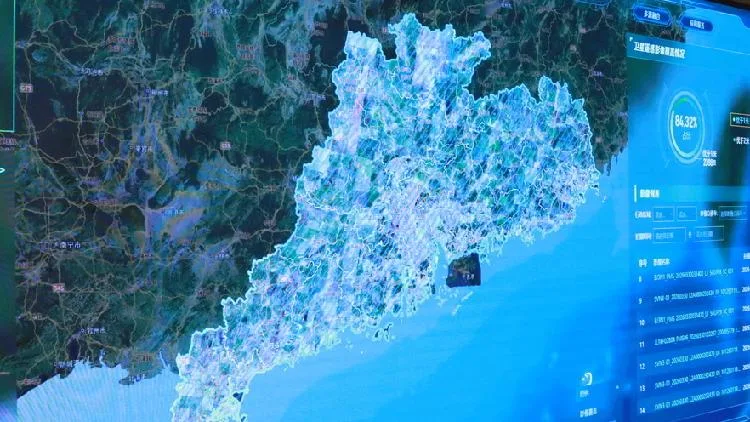
In recent years, Guangdong has been refining what it calls its Integrated Sensing Service System—a database of satellite imagery supplemented by images captured by surveillance cameras, drones and other devices.
Covering the entire province, the system uses computing tools to continuously detect changes on the ground.
此摘要由5News从媒体的公开信息源汇聚而成。 包含完整背景的全文在www.cgtn.com — 内容归CGTN China (oficial)所有。