How do newly released 3D images explain the Gyirong mudslide?
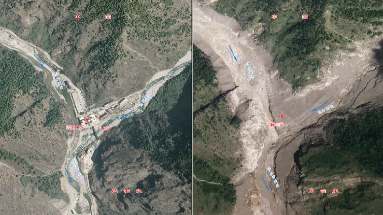
China's Ministry of Natural Resources has released three-dimensional imagery showing the area around Gyirong Port in southwest China's Xizang Autonomous Region before and after a major mudslide, offering a detailed view of the disaster's source, path and impact.
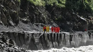
The imagery shows that the mudslide caused extensive damage around Gyirong Port, with buildings, roads and bridges visible in pre-disaster imagery no longer identifiable in post-disaster images.
According to Guo Zhaocheng, a professor-level senior engineer at the China Aero Geophysical Survey and Remote Sensing Center, the ice-avalanche debris flow traveled downstream along the Donglin Tsangpo River before reaching Gyirong Port, where it struck buildings and infrastructure.
Where did the mudslide come from? Experts confirmed the source of the disaster lies in Nepal, not on the Chinese side of the border.
According to Guo, a high-altitude glacier in the upper reaches of the Cuoqian River in Nepal collapsed at an elevation of around 5,140 meters.
The collapse sent ice and rock debris rushing downhill, scouring and entraining loose deposits along the gully and forming a high-speed debris flow.
The debris flow then entered the Guobaxiaqu River, a boundary river between China and Nepal, before joining the Donglin Tsangpo.
It subsequently moved downstream along the river channel and evolved into a large-scale mudslide that struck Gyirong Port and continued toward downstream areas in Nepal.
The disaster is a cascading event: it starts with a high-altitude ice collapse, develops into a debris flow, and finally grows into a massive mudslide.
How fast and how far did the debris flow travel? Experts said the drastic elevation difference between the source area and Gyirong Port accounts for the extreme speed of the debris flow.
The source area in the upper Cuoqian River sits at about 5,140 meters above sea level, while Gyirong Port is at an elevation of around 1,800 meters.
That creates an elevation drop of nearly 3,300 meters over a distance of about 20 kilometers.
Based on available time records, Guo said the glacier collapse began at around 10:52 a.m. on August 26, and video footage showed the mudslide reaching Gyirong Port at around 10:59 a.m.
That means the debris flow traveled nearly 20 kilometers in about seven minutes, with an estimated average speed of around 50 meters per second.
此摘要由5News从媒体的公开信息源汇聚而成。 包含完整背景的全文在www.cgtn.com — 内容归CGTN World (oficial)所有。